Less than an hour from Denver? Check. Beginner-friendly trails with a view? Double check. Like many of the parks in the Jeffco (Jefferson County) Open Space system, Matthews Winters makes it wonderfully beginner-friendly to get outdoors. It’s great to hike, bike, or run without sacrificing views or an entire day.
How do I get there?
The park is almost immediately off of I-70 at the Morrison exit, and while parking was jammed on Memorial Day we still found a spot relatively quickly at 11 a.m. All Jeffco parks are free (thanks, open space sales tax!) and have maps available at the trailhead.
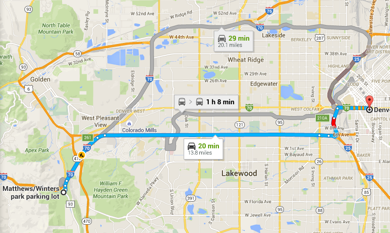
Make sure you navigate to the parking lot, not just “Matthews Winters Park.” Google tries to drop you off on the side of the interstate.
The entire drive is paved, as is the parking lot. Any car can make it there and you’ll be on major highways/roads the entire time.
Where do I go?
Directional signage can be pretty hit or miss at Jeffco parks, but fortunately, you don’t have too many options to get lost.
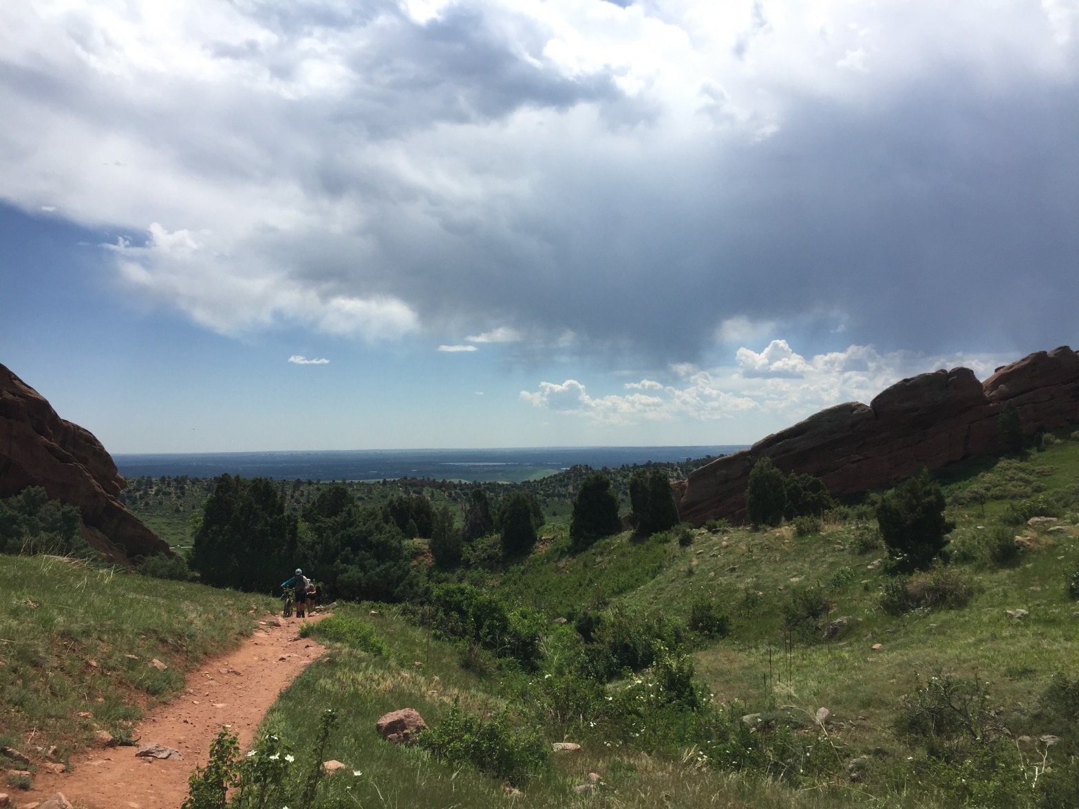
Three-mile (or less) hiking or trail running route
From the main parking lot, the Matthews/Winters trailhead is down the hill. You can always see it immediately from your car, but walk away from the road you came in on and you’ll quickly see the bathrooms and trailhead.
You’re given the choice of Village Walk or Village Ride. It wasn’t immediately obvious to me what those meant – Walk is for hikers and runners, Ride is for bikers. It’s really nice that they separate everyone at the outset, but keep in mind that you will run into mountain bikers on the rest of the trails.
Start out on the Village Walk trail and continue past the Red Rocks Trail intersection. Unless you want to only go for two miles, in which case this is a good turnaround point at the high point of the trail.
You may not have realized it, but you’ve been on the Red Rocks Trail ever since you past the intersection where Village Walk and Village Ride intersect. You also may not realize that you’re leaving the trail (for now) when you pass the second fork. That briefly turns into Cherry Gulch, which is the shorter route. This doesn’t *really* matter in the grand scheme of things unless you’re trying to follow a map or decide on a meeting point.
Ok so you’re on Cherry Gulch now. The trail goes down a rocky hill into the gulch, which involves a water crossing. It’s pretty easy to use rocks to make your way across without getting your feet wet. The creek was totally dry when I ran this in September 2020.
The next intersection is Morrison Slide. This is a very steep trail that goes up and over the mountain that will be on your right. Continue past it (do not turn right up the mountain).
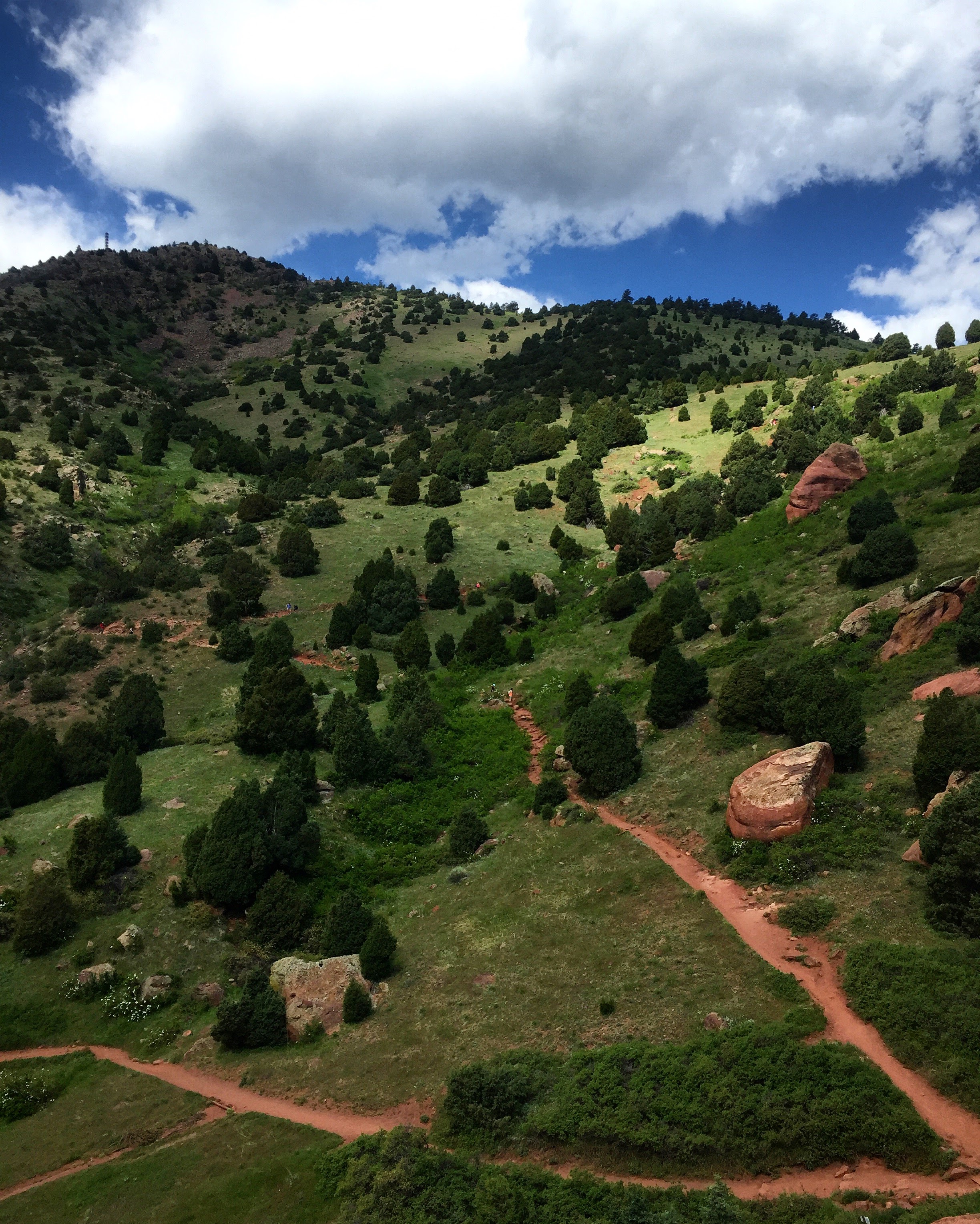
To complete your three-mile loop and head back to the parking lot, stay left at the next intersection to rejoin the Red Rocks Trail. The sign is confusing because both directions point to the Red Rocks Trail. This is because the trail that continues past that is also the Red Rocks Trail (see below map). If you don’t turn left, you’ll keep going away from the parking lot.

Four- to Five-mile route
If you continue on the Red Rocks Trail away from the parking lot, you can hike for as long as five miles (or more!).
For four miles, there’s a really nice overlook toward the end of the trail that makes for a good place to stop to eat and sit in the shade. It’s at the top of some red rock formations, and the trail continues sharply downhill after that. Keep in mind if you continue on, you’ll be hiking uphill the entire way back.
It’s just over a mile to Red Rocks (the park and concert venue) from this point. If you hike as far as the boundary to Red Rocks (there’s a sign), you’ll do about five miles total.
Six-mile route
If you want to get into something bigger, particularly if you’re a trail runner familiarizing yourself with Front Range trail options, try this six-mile loop! For me, it’s a hard uphill run with a lot of rocks, but I like it a lot because of the beautiful views and general challenge.
You could do an out-and-back via Morrison Slide, but I haven’t personally done that so I can’t give you any insight. The loop I discovered with a trail running group takes you around Red Rocks, Matthews-Winters, and Dakota Ridge (across the street).
Instead of starting at the Matthews-Winters trailhead, head east out of the parking lot on foot and follow the cement path to the crosswalk across the highway. This takes you to Dakota Ridge. You start your run/hike with a butt-burner of a hike up the initial hill, and then follow the trail along the hogback for about three miles.
At the Dakota Ridge South trailhead, turn left and head down. You do have to run along the road (there is a wide shoulder) for a few minutes to hook back up with the trail. You’ll see the parking lot and trail sign quickly. Go behind the trailhead sign and back up again onto the hogback, following signs for Dakota Ridge (not the bike trail) and heading downhill over the hogback.
Cross the road into Red Rocks, running along the shoulder until you see the trail sign on your right. Follow that trail until you hit Matthews-Winters. This is a long, slow but steady climb! It’s not steep at all, just a gradual uphill (that kicks my butt). Based on the above loops, pick your preferred trail to get you back to the parking lot.
What Should I Wear?
There is little to no shade on this trail. That means lather up on sunscreen because Colorado sun doesn’t eff around. I would suggest also wearing a hat as my fivehead narrowly avoided sunburn, even with sweatproof sunscreen. Bring sunglasses to complete the trifecta.
There are two places where you have to cross a small stream, which as you may have guessed are the only other two spots of shade on the trail. You can wear waterproof hiking boots if you have them, but the trails aren’t that difficult, so you’ll also be fine in sneakers.
There are rocks to step on at the larger crossing and you can (theoretically) jump across the smaller one. If you don’t stick the landing (guilty), it’s hot and dry enough out there during the summer that your feet will dry quickly anyway. In spring and winter, these sections have a tendency to get very muddy so be prepared for wet feet if you don’t wear waterproof shoes.

For the most part, the trails are very well-maintained and not difficult. There are a few more technical spots that get rocky, but nothing extreme. Matthews Winters is relatively flat, so it’s a great place for beginner trail runners as well as hikers.

Is It Crowded?
Yes, very. It’s one of the most popular close-to-Denver options. The nice part of all the sun means it’s busy year-round since you can stay nice and toasty in winter. If you head out early (before 8 am) you will have significantly fewer people.
You’ll have to share with mountain bikers and horses. There are more of the former and I was pleasantly surprised at the lack of horse poop on the trail. Both parties have the right of way, so be careful stepping off the trail.
Please keep in mind that when you are sharing the trail, the other users have every right to be there too. Yes some bikers are rude, so are plenty of runners and hikers. Yield to other people and generally just understand you aren’t the most important person on the trail. We’re all here to enjoy!
Anything Else To Know About?
Matthews Winters seems to get a lot of attention for rattlesnakes, but I can’t imagine this is an issue on the weekends. Probably because I didn’t see one and I need to tell myself that to sleep at night, but also because the volume of people tromping around doesn’t make for a peaceful place to sun yourself if you’re a snake.
If by some awful stroke of bad luck you get bitten by one after reading this blog, don’t sue me because I’m not a wildlife expert or ranger or in anyway qualified to be making such sweeping generalizations about rattlesnakes.
Despite the fear-mongering headline, this news article actually has great advice for rattlesnake safety (chalk that up under things I never knew were a thing before I moved to Colorado).
Now that you’re good and scared of the outdoors, get out there! In all seriousness, wildlife is a part of life in Colorado but as long as you know what to do when you see wildlife (Colorado Parks and Wildlife’s blog is a great resource), you will likely be fine. Again, not an expert, just good at Googling things for you. Don’t let the fear of the unknown keep you from trying things out!
